In this blog, i will work on database modeling, with pgModeler, i will present UML diagram.
For the purposes of system modeling, the system modeling language UML (Unified Modeling Language) was developed.
UML is a tool for visualizing, describing, building and documenting software support in the analysis and development of primarily software solutions.
Models are created in order to better understand the system because they help visualize the real or imagined system, describe its structure and behavior, represent a template by which the system can be implemented and document all the steps of building the system.
Models help the project team visualize the system being formed and allow recording various constraints on the system.
The example is presented without the use of ISO standards that follow the energy infrastructure, with the aim of showing the way of work and creating the database architecture.
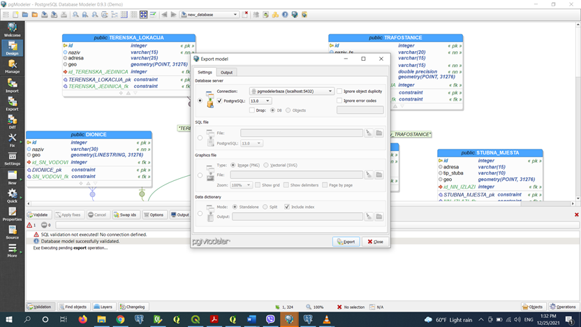
PgModeler enables easy creation and editing of the database, export of formed tables in the form of SQL script, PNG image, SVG file format, HTML form or direct export to the PostgreSQL server.
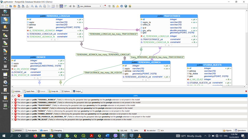
In order to prevent the creation of errors or 'rules', PgModeler has a function that performs checks and in this way the database is formed without errors, with the so-called Validation function.
PgModeler enables the creation of PostGis extensions. PostGis is an extension for spatial databases and PostgreSQL. It is currently the most powerful open source tool for spatial databases. PostGis contributes to PostgreSQL several spatial data types and over 400 functions for working with those data types.
PostGis supports many OGC/ISO SQL/MM features that you can find in other relational databases, such as Oracle, SQL Server, MySQL and IBM DB2 as well as a number of additional spatial features that are unique to PostGis.
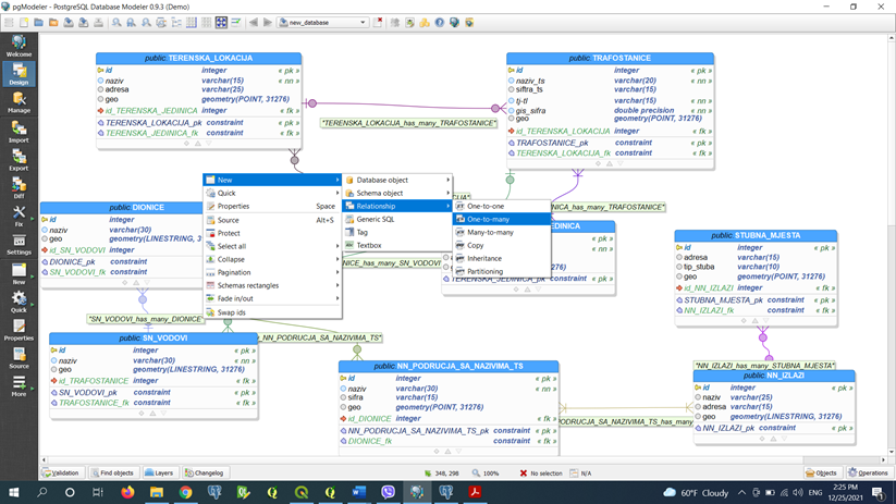
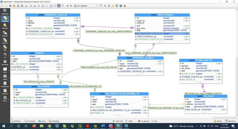
The procedure for creating tables with the necessary columns


No comments:
Post a Comment